Industrial Topography
Industrial Topography of the Czech Republic was a long-term scholarly project of the Research Centre for Industrial Heritage FA CTU in Prague for 2011–2014 supported by grants from the program of applied research and development of national identity Naki Ministry of Culture (No. F11P01OVV0116).
The web interface allows methodical topography industrial processing, storage, networking and ongoing evaluation and thematic research area VCPD a wide range of collaborators. Methodically builds on the register of construction works, its structure is based on data collected layered interlacing, displaying a wider socio-economic and geographical context, with emphasis on the intersection plane of historical context and current / future potential industrial heritage.
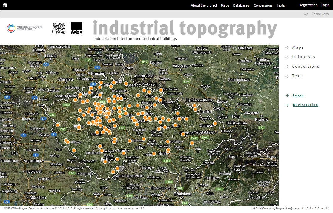
The core of the topographic evaluation of the industrial heritage of the Czech Republic are specialized maps, the structure allows for mutual comparison of quantitative and qualitative records in other databases. The basic criterion or set of reference data has become a region, which corresponds to the phasing of the project only, but also relevant and graspable number of research activities, and especially the specific regional conditions and the structure of territorial administration. Synthetic map allows you to view all points = records in the county of database objects; set aside from this industry (eg breweries, sugar refineries, road construction, etc.) and compare the records with regard to their condition or potential (for example, to highlight the conversion of cultural monuments , attractive tourist destinations, etc.). The topographical views can continuously change the scale radius and angle, switch from normal to orthophoto maps, a detailed study of individual records card information or obtain additional information through web links, or links to specialized texts and reference examples.
The second key industrial level topography database consists of objects whose structure is based on a carefully formulated and chased the methodology of field surveys and archival VCPD repeatedly audited and consulted at the national level and international level. Basic research and for building a natural form of heritage record (identification data, history and current status, resources and literature, photos and attachments, metadata) is complemented by a wide range of general links (websites of towns and villages, the National Heritage Institute, Database VCPD personalities etc.) and detailed information in the form of specific references (projects in the practice or student, territorial or historical plans, the latest news in daily newspapers, archival materials, etc.).
Database of Objects complements Database of personalities (architects, builders, construction companies), which provides research essential dimension of economic and social history, and Database of foreign and Czech examples of the new use of industrial heritage, with the analogous methodological structure and therefore enable mutual comparison and evaluation (eg, history and current state of selected buildings types with examples of successful conversions). Reduced English version started its operation too. Industrial topography is its interdisciplinary span of professional and lay public, and the findings are also continuously made available through printed publications. With regard to copyright processors exploration and willingness to focus a specific user is to enter the web interface requires registration.